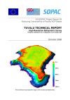
A marine survey for Tuvalu in the waters…
This report describes the high-resolution bathymetric mapping survey carried out in 2004. The survey achieved good coverage of the seafloor from approximately 10 m depth in the nearshore reef slope area, to an average offshore depth of some 2000 m, at an average slope angle of 2. The objective was to investigate the seabed and provide information about water depths around the islands using a multibeam echosounder (MBES).
Data and Resource
| Field | Value |
|---|---|
| Publisher | Department of Environment, Tuvalu |
| Modified | |
| Release Date | |
| Source URL | http://www.sopac.org/ |
| Identifier | bb89a9ce-bf20-4148-9fee-8d4543c956b2 |
| Spatial / Geographical Coverage Location | Tuvalu |
| Relevant Countries | Tuvalu |
| Language | English |
| License |
SPREP Public Licence
![[Open Data]](https://assets.okfn.org/images/ok_buttons/od_80x15_blue.png)
|
| Author | Jens Krüger (SOPAC Secretariat) |
| Contact Name | SOPAC Secretariat |
| Contact Email | [email protected] |

